Lemon Squeeze . Catskill NY

On a visit to the Catskills this September to visit my sister and family, we were able to check off a hike that has been on my list for a long time … The Lemon Squeeze Scramble.

The full hike is Duck Pond to the Labrinth to Sky Top Road Loop, which is a 6.8 mile loop through many different types of terrain, offering amazing views!

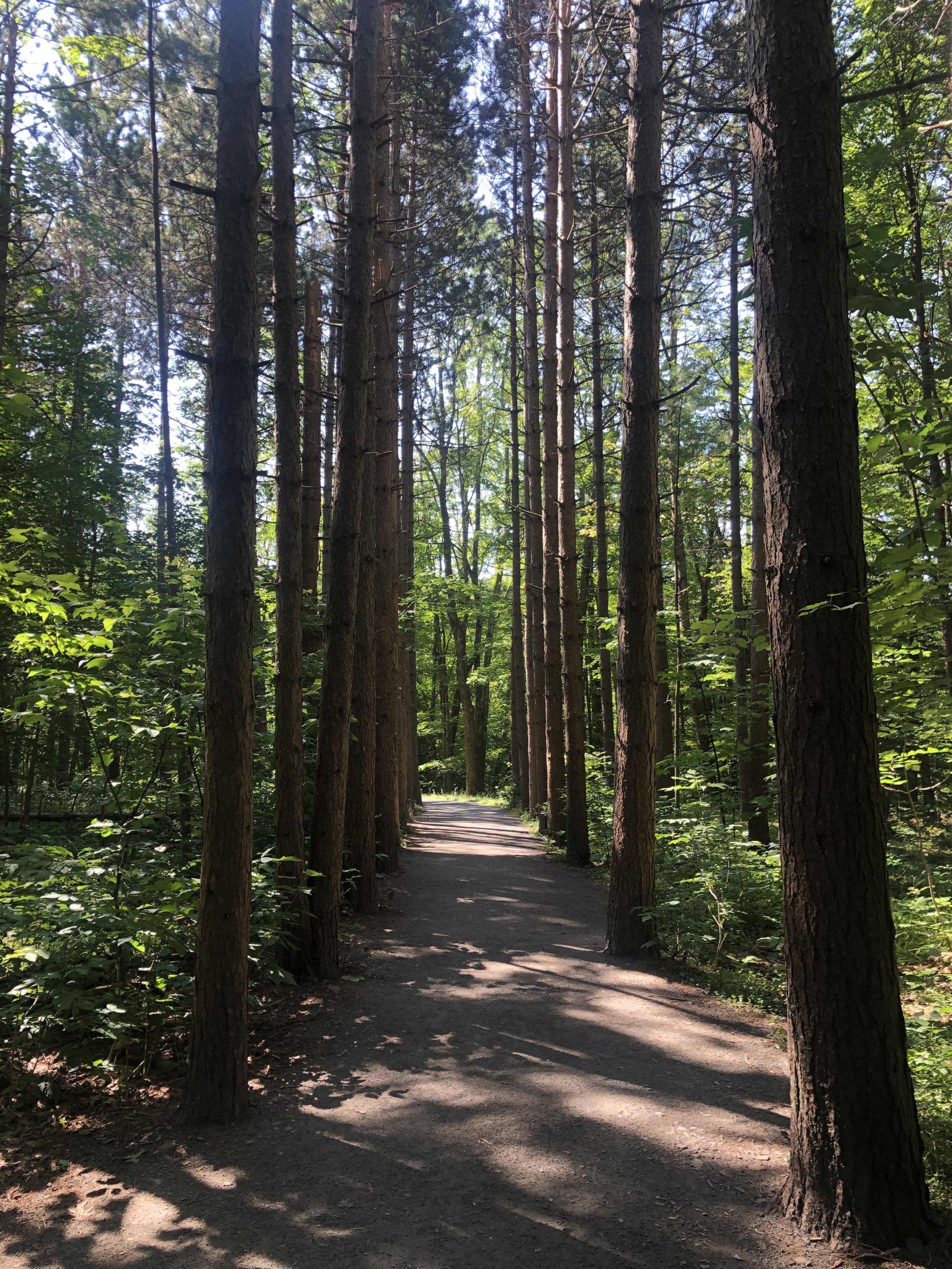
The parking is a short walk from the start of the trail, and if you arrive before 9am you do not have to pay the $35 fee per hiker. The trail starts on a gravel road as you make your way to Duck Pond. The pond was filled with turtles basking in the sun. Once you make your way around the pond you start making the incline hike to the top of the mountain. There are many different paths to take, we chose to stay on the Duck Pond trail to make it to the Sky Top view.

The trail was filled with boulders and crevices and the path marked by red arrows spray painted on rocks. A fun part of the challenge was looking for the next red arrow, a few times we made our own path, but got back on track pretty quickly. As the boulders get bigger the spaces got smaller. We passed through a few holes until we got to our first summit, which offered an amazing view before heading through the Lemon Squeeze rock scramble.

The Lemon Squeeze is made up of ladders and tight spaces as you make your way to the final summit. After going up a few ladders you get to the tightest spot, this required me to take off my backpack in order to squeeze through. After you climb up the sideways ladder you have to pull yourself up out of the crevice.

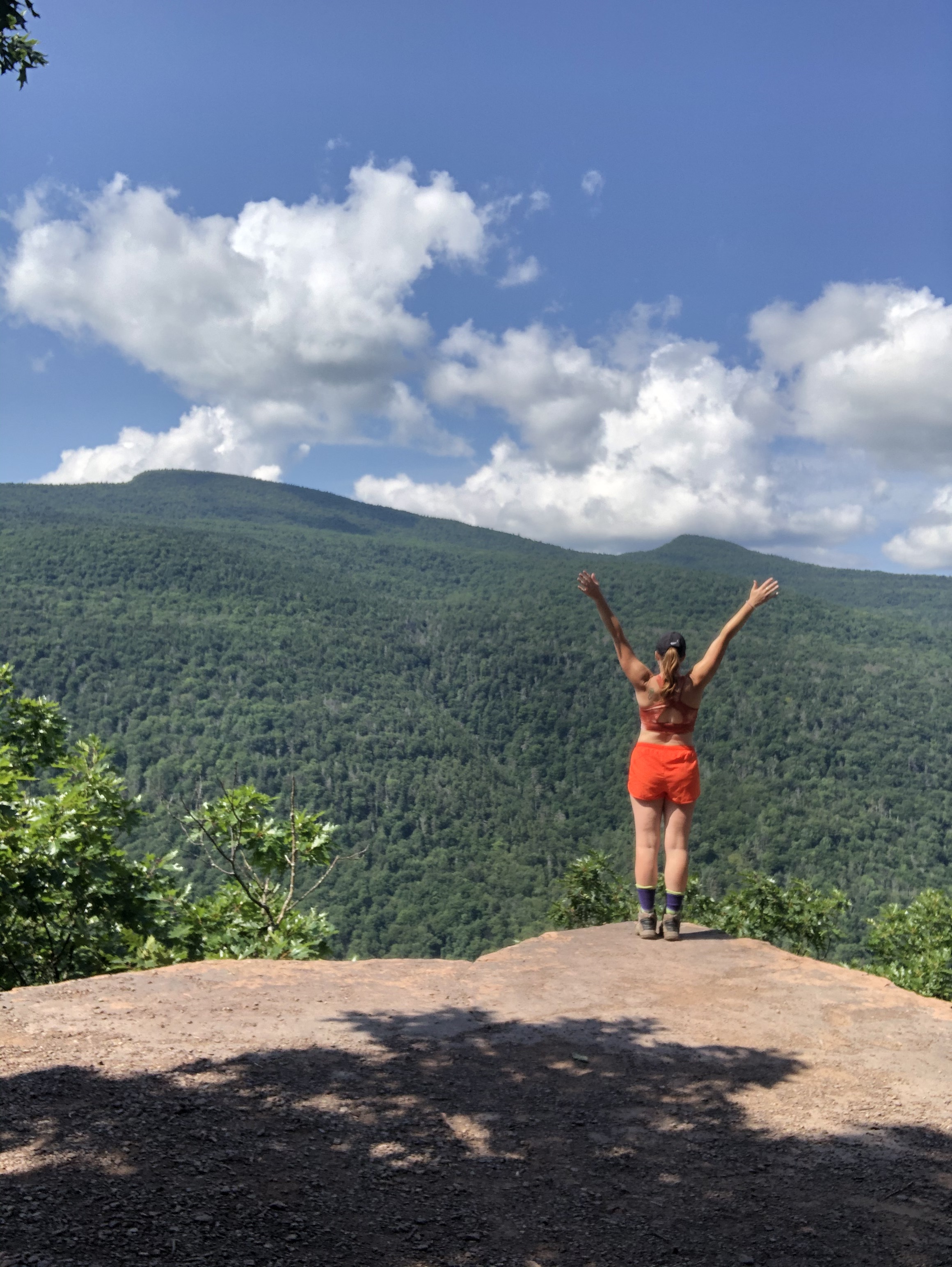
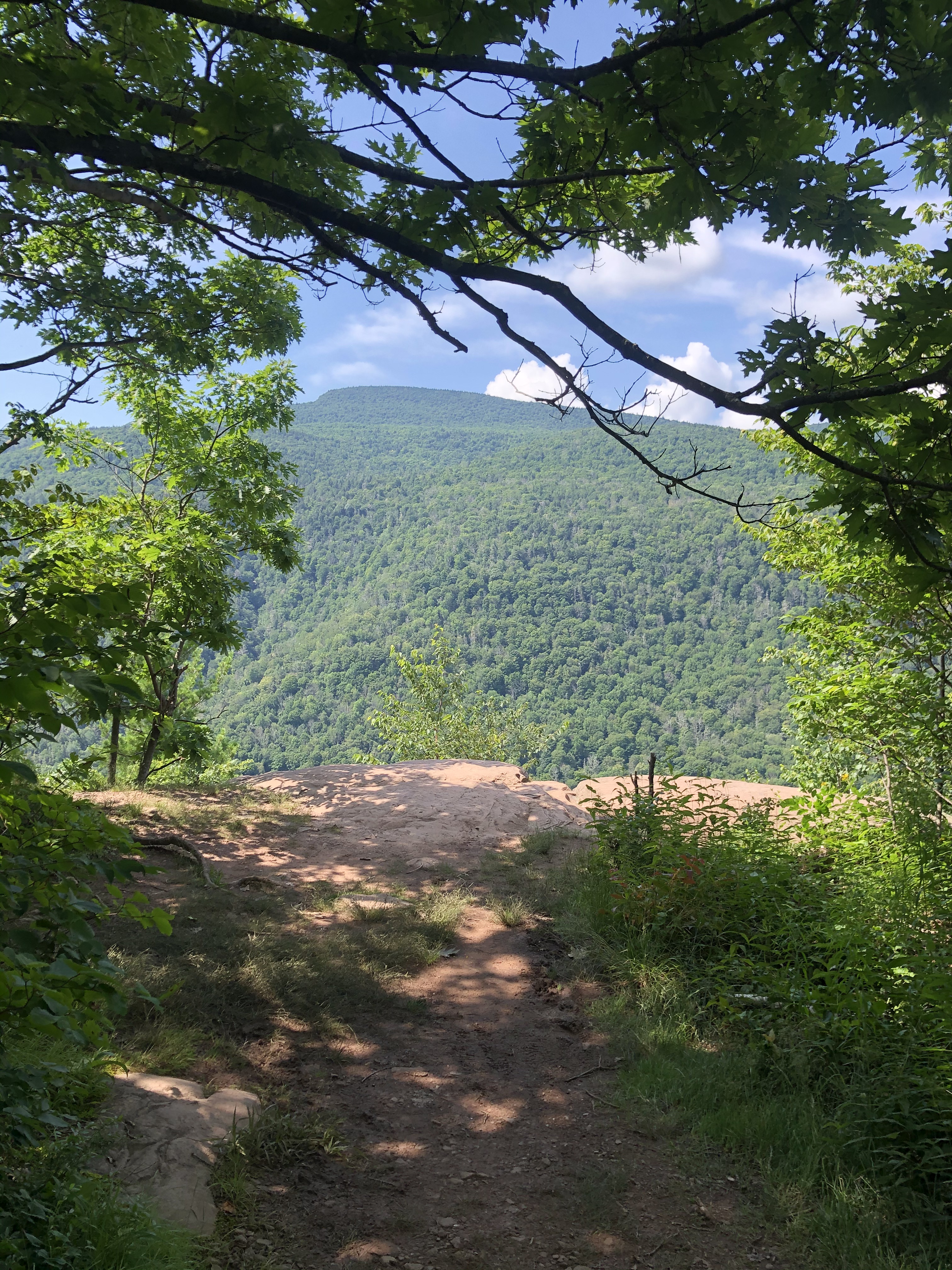
The hard work is worth it! The view from the top was spectacular, it was a beautiful sunny day and we were able to take in the full view, including six different states, and the Mohonk Resort and Lake.

After taking in the view we made our way up to the Sky Top Tower. Made out of rocks, this tower was constructed in 1923 as a memorial to Albert K. Smiley. At the top of the stairs is a platform you can walk around at 1542 feet above sea level.

We made our way down heading towards the Mohonk Resort. There were numerous paths, the one we took led us past the outside venue located at the resort and they were setting up for an Oktoberfest.

We then took a quick walk following the shore line of the Mohonk Lake, up through the trails surrounding the resort to head back towards the trail to our car.

The trail offered an array of overlooks with benches, and many were filled with couples taking in the views.

The trail looks us around the loop and we cut 2 miles out of our return by making a few of our own paths. We even spotted a snake sunbathing, thankfully it did not have a rattle tail.

This was hands down one of the most challenging hikes we have done so far, highly recommend if you are in the Catskill area!

Rooster Comb

Hiking can be compared to a glimpse into our lives. There are ups and downs, boulders, roots – all trying to take you down and stop you from reaching your goals. The pain and struggle, the bumps along the way, all will ultimately lead you to a pure moment of beauty, that words sometimes can not describe, and the best way to experience it is to breathe it all in and never to take a second for granted.

I set out for every hike prepared, with a plan, where I am going, how long I want it to take me and sometimes forget that I get the opportunity to just be, and experience the moment. For me slowing down and truly enjoying just a good day is rare, I always have something on my mind that is dragging me down or putting me in a different mindset.

Today I attempted to not focus on the future, forget the past and live in the high peak, leaf season, moment.

Rooster Comb Trail – 4.5 miles round trip, 1,729 ft elevation

Since it is almost peak leaf season there were quite a few people on the trail, but not so busy that you were weaving in and out of people.

There is a small pond before the trail really start that you can choose to walk around that leads back into the parking lot. The trail starts with an incline and it rarely stopped until reaching the top. The terrain was filled with moss, fallen red and yellow leaves, boulders covered in tree roots, and many fallen logs to stop for a quick breather and a sip of water.

Before getting to the top of the mountain you need to climb a small ladder, this can be done with dogs, since there were a few on the trail that made it up. The top offers many areas to sit and take in the mass array of colors that the high peaks has to offer in the fall. Reds, yellows, orange and still a tint of green for miles and mile. Every direction you look provides you a different view of the mountains in the distance.

There were people on top eating lunch, having conversation, and even taking photo shoots.

A few moments were had taking in the views, the sunshine and a lunch of beef jerkey, and banana chips. On the way back down was an option to take a side trail to view the Valley View Ledge – just a short .1 miles, it was worth another view of the beautiful mountains.

Although a shorter hike in the High Peaks region this hike provided a great workout and fantastic views – highly reccomend if you are looking for a view of the fall folliage this season.

This is my happy.

Valley of Fire . Nevada

2023 has been the year of trying to find balance – good news – I made it through June

Hiking was put on hold for a while – work, life, everything in existence happened to stop me from getting to the top of a mountain.

I went to Las Vegas for a conference in the beginning of June and decided it was time to get back into my boots and get some red rock ingrained into the seams.

I found a local company that provides hiking tours in the Vegas area. Love Hikes , offers different tours based on area and difficulty. I chose the moderate hike, which was a 3-5 hour journey. A nice guide, Nick, picked me up at a nearby hotel, along with two other “hikers” and drove us to Valley of Fire State Park, which was roughly an hour from the Vegas strip.

We showed up around 7am so there was no one else out on the trails. As we drove to the trailhead we saw some sheep/rams getting their breakfast in before the crowds took over.

Most of the hikes in the park are only a short loop, Nick took us off the trail and into the massive red rock maze. Before we set out on our hike he provided us with a fantastic snack selection, including slimjims and water and gatorade for us to take. He also had extra backpacks, which was great incase you didn’t pack one.

To prepare hikers for the challenge they are entering, they have included a new sign to warn you of things to come.

YOU MIGHT DIE.

Nick was extremely informative of the area, including the history of the park, the insects and plants that surrounded the other planet terrain we were entering.

Everywhere you looked there were different formations of what was left of a pre-existing sea. It is amazing to think that at one point this was all underwater – truly a different world as it stands today.

We stopped on a nice shaded rock to enjoy our snacks and get out of the sun for a few minutes. It was pure silence and clear mind – taking all that was in around us.

As we walked back to the main path, we went through a small cave, and enjoyed a few scenic spots to take pictures – to ensure that we can brag we have been in this unbelievable spot.

Before ending our hike we were able to see hieroglyphics that are still visible on the rocks from a life previously lived in this amazing atmosphere. I did not capture a photo, other than in my mind where it will stay for now. By the time we ended the hike the visitors center was open. They have a small museum and a shop.

Overall it was a great experience and I highly recommend LoveHikes for any adventure you plan on taking near Vegas.

Valley of Fire re-ignited my passion for the love of the hike – ironic.

Moxham Mountain

It was perfect hiking weather this past Labor Day weekend, I made a spontaneous trip to Minerva to hike Moxham Mountain. The drive took me around 2 hours which led me to a dirt road. The road lasted roughly .5 miles until you reach the trailhead and parking lot. The parking lot was very small and held 4-5 cars, however the road was lined with 10-15 cars.

The trail started out moderate and slowly gained incline, taking you through many different types of forest. There were root covered paths, small streams, and rock ledges that were covered in moss that from afar looked like snow.

I passed quite a few groups on my way to the summit, including a large group with a small dog that had enough. The trail to the top is roughly 2.5 miles and had many small overlooks that offered great views.

I kept an active pace and made it to the summit in roughly an hour. There was a family at the very top, so I chose a larger area next to the summit to sit and enjoy some breakfast and take in the views.

There were a few ponds and there was a fantastic view of all the surrounding mountains. The sun appeared for a few moments and mixed with the clouds it created the perfect backdrop.

I spent 30 minutes at the summit and as the groups I passed (including the small dog) started filtering in, I chose this as an opportunity to head down the mountain. I stopped at another overlook and took a great photo of the rock edge that leads to the summit. If you look at the very top of the ledge, this is where I ate my breakfast.

I also took time searching the sides of the trail for mushrooms. I found a few unique fungi, photos below. (view my Mushroom Montage https://hikinggypsy.home.blog/2020/11/22/mushroom-montage/ post for more photos from this hike and previous adventures)

As I made my way back to the parking area there were a few groups heading up the mountain. The weather was getting very windy and it was starting to rain, so I made it back in perfect timing.

I always love traveling to these small towns and seeing different trailheads along the way. I wrote down a few new hikes I am going to explore, such as Eleventh Mountain. There is also a new brewery in Speculator called Lemontree Brewery. I can’t wait to check it out when I do my yearly fall hike up Panther Mountain.

Kaaterskill Falls Rail Trail to Inspiration Point

I started the trail at Kaaterskill Falls Rail Trail. It was the site of the Ulster and Delaware Railroad Station, which was established in 1913. The trail was very wide and lined with old railroad ties. The original ad for this station stated it was “The Only All-Rail Route to the Catskill Mountains”. The station is still standing and seems in good condition, however it was not open for me to check out the inside.

The trail is roughly a mile and then you come to the other Kaaterskill Falls trail entrance. The trail is lined with huge trees and a gravel path. Following this path you can get to many other trail options. My first choice was Inspiration Point. My research I had done before this hike showed that this trail offered the best views, with many different overlook options.

The hike to Inspiration Point was 1.7 miles to the summit. The terrain was extremely muddy due to all the rain we have been having. The elevation went downhill before bringing you back up to climb to the summit. There were even a few areas that you needed to use your hands to lift yourself up.

Halfway to the summit I came across “Layman Monument”. This structure marks the spot the Frank Layman died, on August 10th 1900, while fighting a forest fire that was going to destroy the home and businesses in the surrounding area.

Overall the climb to the summit was moderate, and there were many places to stop and enjoy the view of the surrounding mountains. Once I reached the top I enjoyed a nice breakfast and rehydrated before heading back down to check out the falls.

To see the falls you can choose between three different options. The first trail I chose brought me to the bottom of the falls. To get to the bottom you need to climb down 181 stairs, that get extremely slippery and steep. There were so many people at the bottom of the falls. Some were swimming, some were enjoying lunch and some were admiring the views of the waterfall. I didn’t spend too much time at the bottom, due to all of the people. I next went back up stairs, and at about the half way point there is an option to see the upper falls.

At the upper falls there is also an area to swim, and this was packed with people, swimming, sunbathing and climbing up behind the waterfall. I took my shoes off and tested out the water, and did some people watching before heading back towards my car.

In total I hiked around 7 miles before I was back at my car. Once I got to the car I found a local brewery to enjoy lunch and a well deserved cold beer.

The place I chose was called Old Factory Brewing Company, located in Cairo NY. It took me around 25 mins to get to the brewery from the parking lot of the trail. The brewery had numerous draft options, I chose the Blonde and ordered some lunch.

I saw on their outside patio, which had tables and a bar type option that looked out onto the road. For lunch I had a grilled cheese sandwich with fries. Sandwich Contents: Brie, Apples, Arugula, Ham

I really enjoyed this trip, but I would avoid going in the afternoon due to the amount of “hikers” wearing jeans.

Welcome To Narnia

Our first real snowfall happened this week and that meant I could break out the snowshoes.

I always have places that I return to year after year, during all seasons, and always seem to have a new experience. A local park in the town I grew up in is one of those places. It is called Russell Park, and has great trails for walking, running, snowshoeing and x-country skiing.

The main path is the Horseshoe Trail, and there are many other trails that branch off. The trail is roughly 1 mile, but if you choose to go down other trails, you can easily add one more mileage.

During this trip I chose to the the Horseshoe, and the Rabbit Trail. The snow was extremely deep and not many people had been out on the trails. The trees were still covered with the fallen snow, and every once in a while a heavy branch would release a shower of snow.

The Rabbit Trail provides a nice loop that brings you back onto the Horseshoe Trail. This trail was fresh, with no prints, so it was a little bit harder to navigate. Thankfully a local boy scout troop has added new signs and provided me with a guide to get back to the main trail.

This trail system offers a great workout and beautiful scenery, and is very local to the area. I will be visiting many other times this winter season.

Acadia National Park

After an 8 hour drive, I was lucky enough to spend a weekend in Bar Harbor, Maine, with my sister, her fiancé and his family. We rented an Air BnB 15 minutes from Acadia National Park and spent the weekend taking in as many hikes as we could.

Our adventures included:

A 6am sunrise on Cadillac Mountain with close to 100 other people. We drove up this mountain and waited for an hour in the cold, wrapped in blankets, to experience the first rays of sun cover the mountain. As soon as the sun appeared everyone clapped, it was such an amazing experience.

Beehive Mountain was a difficult climb, which included iron rung ladders and extreme heights. It is crazy to know that when you reach the top you are actually looking out to the ocean, not a lake. The contrast of the beach and the forest is such a unique thing to see. After reaching the summit, this hike led us down to a small lake and then we made our way back up to the parking lot.

Jocelyn and I separated from the group and hiked one of the fire towers in the area. Beech Mountain Fire Tower was constructed in the 1940’s, the tower itself was short and the cabin was locked, but it was a great hike. This hike also led to to Long Pond Lake, which was a body of fresh water carved by a glacier. This trail wrapped took us to the lake and we took another trail that presented great views and took us back to the parking lot.

Our next mountain to conquer was North and South Bubble. “The Bubbles” as they are referred to, both had well marked trails that were challenging and offered extraordinary views.

Champlain Mountain was our last hike of the trip and by far the best. This was one of the most strenuous hikes I have been on. The entire hike provided amazing views of the ocean and many steep rocks to climb. There were also parts of the trail that were covered in brush and made it seem like you were entering an enchanted forest. Once we were at the top the trail broke off into many different other trails that you could take back down. We chose to return the way we came so that we could get back to our vehicle.

There were so many hikes that we couldn’t get to, but you can only do so much in 3 days. I will definitely be back to Bar Harbor, for the lobster and the hiking.

Crane Mountain

If you like an adventure, then this is the hike for you. Equipped with ladders, great views, and a pond with watering holes, this hike had it all. There are two options to the summit, one is a shorter hike that includes the ladders, the other is longer and brings you around the pond to the summit.

I chose to take the shorter hike, because I really wanted to test my ability to deal with heights, by climbing up the 30 foot ladder. The hike was very strenuous and gained a lot of elevation in short amount of time. Then you get to the ladder, and just looking up can make you nauseous.

My recommendation is too keep climbing, and don’t look down!

Once you get past the ladder it is smooth sailing to the summit. The views from the top were amazing and I spent quite a bit of time at the top taking it all in.

I chose to take the other trail down, past the pond, which made it a total hike of 4.1 miles. The below view is looking up at the summit, leading down to the pond. At first I thought I was walking down the wrong path, but then I saw the pond and knew it had to be the right place.

The pond offered many different areas to take a quick dip, and relax in the sun. I found a spot to myself and took off my boots.

I became a little lost on my way back to the parking lot, and missed one of the turns. Thankfully I was led out to the road, and took the correct turn that led me back to the parking lot.

]

Chimney Mountain

This hike has made its way into one of my top favorite hikes. Not only did the hike provide a great workout, but the caves and views from the top were incredible.

When I first pulled into the parking lot I was greeted with 20+ bluejays! I have never seen so many in one area. Along with a huge parking lot, there are many cabins that are available for rent. This option provides the perfect get away with easy access to the trail head and surrounding area hikes.

Along with private cabins there is also an area for a group bonfire, which must be enjoyable after a long day of hiking.

At the trail head there is a sign in sheet and the cutest outhouses, I know outhouses are not the most glamorous thing, but I had to capture a photo of the “does” and “bucks” options.

The trail is 2.5 miles round trip and I would rate it as moderate. Although I completed this hike in September, it was still extremely hot and I worked up a sweat.

The trail was easily marked and provided great stone stairs, streams and small hills throughout the hike.

Along with the hike being beautiful and enjoyable, nothing can compare to the summit. With massive rock formations and caves galore, this was one of the reasons this became one of my favorite hikes. You could easily spend hours exploring the caves and climbing the rocks. It was extremely windy when I made it to the top, so I was a little nervous to climb too high. I also did not have any rock climbing equipment, but if you are an avid rock climber, you would definitely want to pack accordingly for this hike.

Along with all of the interesting spaces to explore, the view of the Adirondack mountain range is breathtaking. I could have spent the rest of the day looking out at the green ocean of the forest.

The trail is a loop so the trip back down the mountain is the same route that you take on the way up.

Sawyer Mountain

I took this Sunday adventure solo. The trail was located near Blue Mountain Lake. and it is a short 2.1 mile round trip hike. I think it took me longer to drive here, than hike the mountain. But it was well worth it to get out and enjoy a nice fall day and to take in some fresh mountain air.

The trail has a small parking lot and is located off of a main highway. The weather on this particular day was perfect for this hike, although a bit windy, the sun was out and the leaves made a trail of fire to the top.

The hike was a moderate climb and was not too busy. I only passed a handful of people and a huge black dog named Doug, that I thought was a baby black bear.

There is no path to the true summit of the mountain, and other bloggers have stated there is no view from the summit either. Although you are unable to get to the very top of Sawyer Mountain, there is still a great rock platform that offers amazing views and a change to relax before heading back down.

I spent around 30 minutes at the top, enjoying the view and eating a small snack, before heading back down to the parking lot. Most of the leaves had already fallen, but there was still a slight orange glow across the range.

I ended up running down the mountain to complete my quick hike.

After reviewing other posts about this mountain, it seems like a great trail for snowshoeing. I will definitely be heading back to Sawyer Mountain this winter to test that out!